Colorized Sub-aperture Image
Info
Colorized Sub-aperture Images are only produced when the Dwell collection mode is utilized
Colorized Sub-aperture Image (CSI)
Colorized Sub-aperture Images are made by coloring the backscatter received for different sub-apertures and combining it into a single product. The colors denote the direction that a point in the image predominantly scatters in. The collection time is split into individual sub-apertures. Each sub-aperture is individually colored from red at the start of the collection to blue at the end of the collection. A composite image is made by combining all the sub-apertures and it can be interpreted as follows:
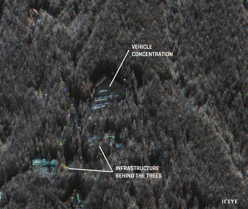
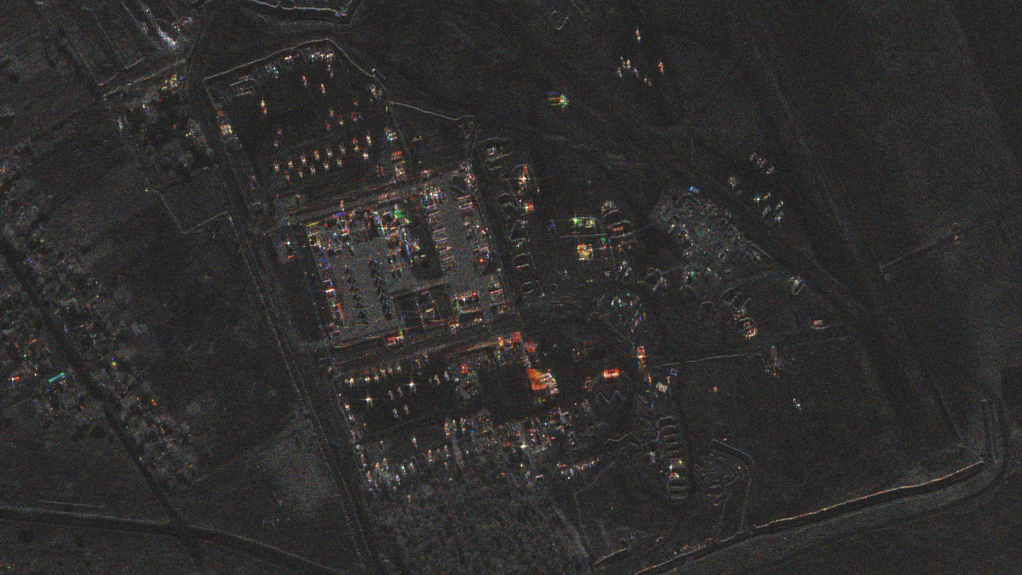
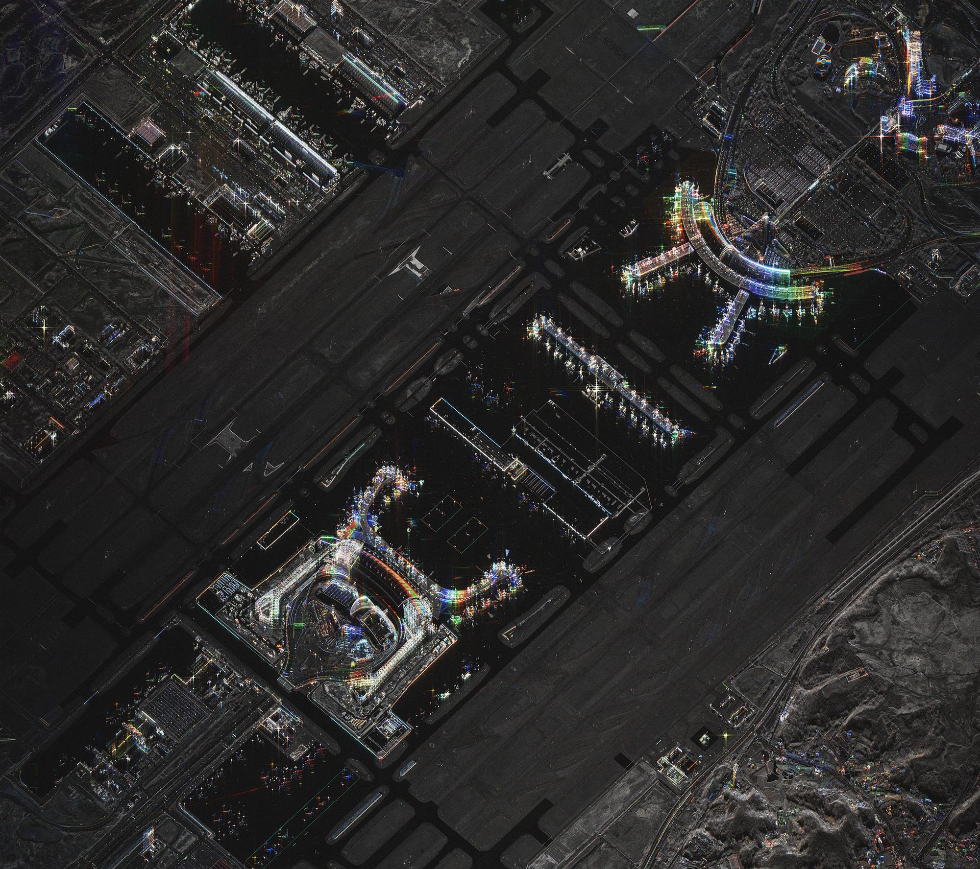
- Isotropic scatterers: Objects on the ground that scatter an equal amount in all directions have an equal brightness in all directions that they are looked at. When the individually colored sub-apertures from these areas are added together, each individual color contribution is roughly the same making their appearance in the CSI image a grey-scale - like a normal SAR image. Examples of isotropic scatters are grass, trees and water.
- Anisotropic scatterers: Objects that have a dominant reflection in one particular direction will retain that color after all the sub-apertures are combined. Objects that have preferential scattering orientations usually have flat surfaces and/or sharp angles and indicate that they are human-made. Objects that are partially obstructed by vegetation or tree canopy will also be highlighted in a dominant color. As the human eye is very good at picking out colors from grey tones, our eyes are naturally drawn to the human-made features.
ICEYE is able to produce Colorized Sub-aperture Images (CSI) only for certain types of collection characteristics such as Dwell. In the case of Dwell, each CSI is made up of 13 sub-apertures, each containing the data acquired during less than 2 seconds. The total duration of a Dwell acquisition is 25 seconds. The exact time, duration, color and satellite location for each sub-aperture is available as metadata in the GeoTIFF product file.
Dwell sub-apertures and colors
The nominal duration and color for each sub-aperture in a Dwell collection is documented in the table below. Please see Notes and Explanations for more detailed information as well as corresponding values in the image metadata.
| Sub-aperture | Nominal Duration [sec] | Color (RGB 0-1) | Color |
|---|---|---|---|
| 1 | 1.91 | 1.0000, 0.0000, 0.0000 | ██ |
| 2 | 1.91 | 0.9994, 0.0333, 0.0000 | ██ |
| 3 | 1.91 | 0.9864, 0.1644, 0.0000 | ██ |
| 4 | 1.91 | 0.8944, 0.4472, 0.0000 | ██ |
| 5 | 1.91 | 0.6000, 0.8000, 0.0000 | ██ |
| 6 | 1.91 | 0.2334, 0.9724, 0.0000 | ██ |
| 7 | 1.91 | 0.0000, 1.0000, 0.0000 | ██ |
| 8 | 1.91 | 0.0000, 0.9724, 0.2334 | ██ |
| 9 | 1.91 | 0.0000, 0.8000, 0.6000 | ██ |
| 10 | 1.91 | 0.0000, 0.4472, 0.8944 | ██ |
| 11 | 1.91 | 0.0000, 0.1644, 0.9864 | ██ |
| 12 | 1.91 | 0.0000, 0.0333, 0.9994 | ██ |
| 13 | 1.91 | 0.0000, 0.0000, 1.0000 | ██ |
Container format and metadata
The CSI format uses a regular GeoTIFF container so the image can be viewed by any regular (or geospatial) image viewer. Important metadata on each of each of the sub-apertures and how the CSI is formed is available in the GeoTIFF. GeoTIFF metadata can be accessed by multiple methods including:
- Using the gdal library and running the command
gdalinfo filename.tif(for example:gdalinfo ICEYE_X2_VID_SLED_1906432_20231020T110813.tif) - Using the open source application QGIS and selecting Raster → Miscellaneous → Raster information → Run
Key CSI GeoTIFF Metadata
| Metadata Element | Description | Type | Unit |
|---|---|---|---|
FRAME_COLOURS |
RGB 0-1 color code of each sub-aperture. | List of float64 triplets | RGB 0-1 |
FRAME_DURATION |
Duration of SAR data collection for each sub-aperture. | List of float64 | seconds |
FRAME_MID_TIME |
Timestamp at the center of each sub-aperture. Number of seconds since the beginning of the SAR collection. | List of float64 | seconds |
FRAME_POS |
Satellite position at the center of each sub-aperture | List of float64 triplets | ECEF coordinates |
FRAME_VEL |
Velocity vector of the satellite at the center of each sub-aperture | List of float64 triplets | meters per second |
Notes and Explanations
- Sub-aperture duration: The duration of the sub-aperture varies slightly depending on specific collection characteristics. The actual duration value is available in the GeoTIFF metadata.
- Sub-aperture colors: Nominal colors for each sub-aperture are listed in the metadata table to facilitate interpretation. The normalized RGB color contribution of each sub-aperture is available in the GeoTIFF metadata element FRAME_COLOURS.